At Dronariss, we always keep track of technological developments on the battlefield, and recent satellite monitoring data confirms the trend of increased use of drones and electronic warfare (EW) systems in Ukraine.

Satellite Data Analysis
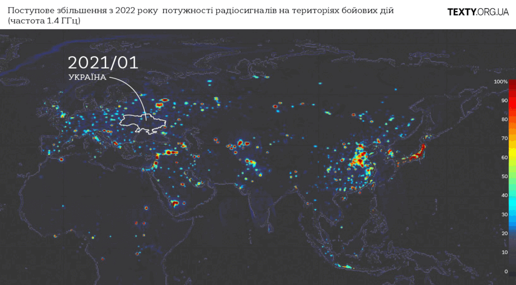
Images obtained via NASA’s SMAP satellite mission provide a detailed assessment of changes in radio signals in active conflict zones. SMAP uses a radiometer to measure radiation at a frequency of 1.413 GHz on the Earth’s surface, which is typically used to determine soil moisture and water salinity. However, when the satellite detects stronger signals at this frequency, such as from communication equipment or EW systems, these are marked as “radio anomalies” or interference.
Recent satellite images reveal a significant increase in such anomalies over Ukraine, which is directly related to the development of technologies like FPV drones and the systems designed to counter them. We can clearly see a rise in radio signal intensity since February 2022, when the conflict reached a new phase.
What This Means for Military Operations
The increase in unnatural emissions in conflict zones indicates widespread use of EW systems to counter drones, which have become a crucial element of modern warfare. Drones are being used for numerous tasks, from reconnaissance and artillery adjustment to precision strikes. This has prompted the opposing side to deploy various technologies to block signals and disrupt control over unmanned vehicles.
At Dronariss, we note that the rise in these radio anomalies indicates an intensification of technological warfare on both sides. FPV drones and countermeasures against them are becoming decisive factors on the battlefield.
Trends in Other Regions
Similar radio signals have been detected not only in Ukraine. Since late October 2023, increased radio anomalies have been observed in Myanmar, where armed clashes continue between the military junta and insurgents. Additionally, a powerful signal was detected in China’s Xinjiang province, where the Chinese government continues its repressive policies against the local Uyghur population.
Conclusions
The analysis of satellite images confirms the growing use of drones and electronic warfare systems in modern conflicts. For Dronariss, this is yet another confirmation that technological innovations, especially in the field of FPV drones, continue to play a crucial role in contemporary warfare. We are constantly working to improve our solutions to stay at the forefront of these technological advancements.